Thousands of low-income renters in Queens at risk from rising seas, report finds
/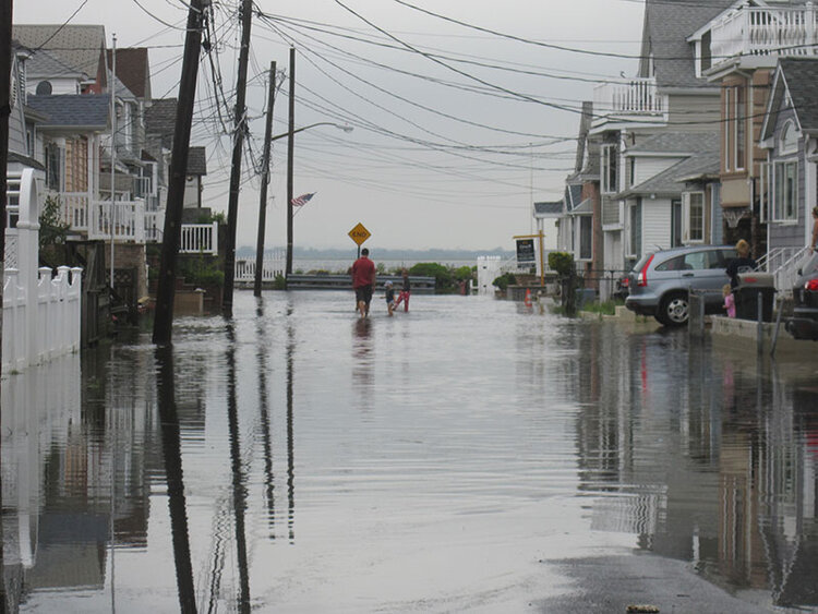
Rising sea levels and subsequent flooding will leave thousands of New York City’s affordable housing tenants at risk, according to a new study from Climate Central and the National Housing Trust. Photo via nyc.gov
By Rachel Vick
Tenants in nearly 1,800 subsidized housing units in Queens could be displaced as a result of rising sea levels over the next 30 years, according to the first nationwide analysis of the climate crisis’ impact on affordable housing. Nearly all of the impacted units are located in the eastern portion of the Rockaway Peninsula, including Far Rockaway and Arverne.
The peer-reviewed study published by the organization IOPScience found that flooding will render more NYCHA, Section 8 and other subsidized homes unlivable in New York City than any other city in the country by 2050.
Authors Maya Buchanan, Scott Kulp, Lara Cushing, Rachel Morello-Frosch, Todd Nedwick and Benjamin Strauss refer to these subsidized units as “affordable housing” as they consider the impact of rising sea levels on 20 vulnerable coastal cities including Boston and Miami Beach.
“The frequency of coastal floods around the United States has risen sharply over the last few decades, and rising seas point to further future acceleration,” they write. “Residents of low-lying affordable housing, who tend to be low-income persons living in old and poor quality structures, are especially vulnerable.“
An interactive map published alongside the report shows the specific communities facing the greatest risk, with nearly all the units concentrated in Far Rockaway and Arverne. The two neighborhoods have a high number of NYCHA and Section 8 units compared to other waterfront neighborhoods of Southeast Queens and the Rockaways.
A city plan to rezone coastal communities for greater resiliency highlights the dangerous impact on Broad Channel, Howard Beach and the neighborhoods around Flushing Bay, as well. All are expected to fall below the floodplain by 2050.
The IOPScience report anticipates factors 30 years in the future, but New York City already has among the highest number of units vulnerable to flooding at least once a year, the authors write.
At least 1,373 subsidized units are vulnerable right now, a total that represents less than 1 percent of the city’s current affordable housing stock, according to the paper by Climate Central and the National Housing Trust.
“Climate-change-driven sea level rise will continue to amplify coastal flooding in the coming decades,” the report states.. “As community resilience investments are made, complementary policies may be needed to protect against the displacement (and potential homelessness) of residents.”
While the number of affordable housing units exposed to coastal flooding by 2050 is projected to exceed 4,700, New York City has more resources to develop infrastructure for resilience than other cities and is already adapting building codes to prepare.
The city, state and federal government have committed to investing $128 million in NYCHA buildings damaged by Hurricane Sandy, according to a 2019 report from the Mayor’s Office.
Some leaders say the city has not yet protected low-income residents, however.
“Our city is responsible for mobilizing to protect New Yorkers the minute the next storm strikes and we can’t let NYCHA residents, shorefront communities, or vulnerable New Yorkers suffer because we didn’t learn our lessons from Sandy,” Comptroller Scott Stringer wrote in a letter to Mayor Bill de Blasio last year.