SE Queens remains ‘shameful’ omission in NYC’s pedestrian streets plan
/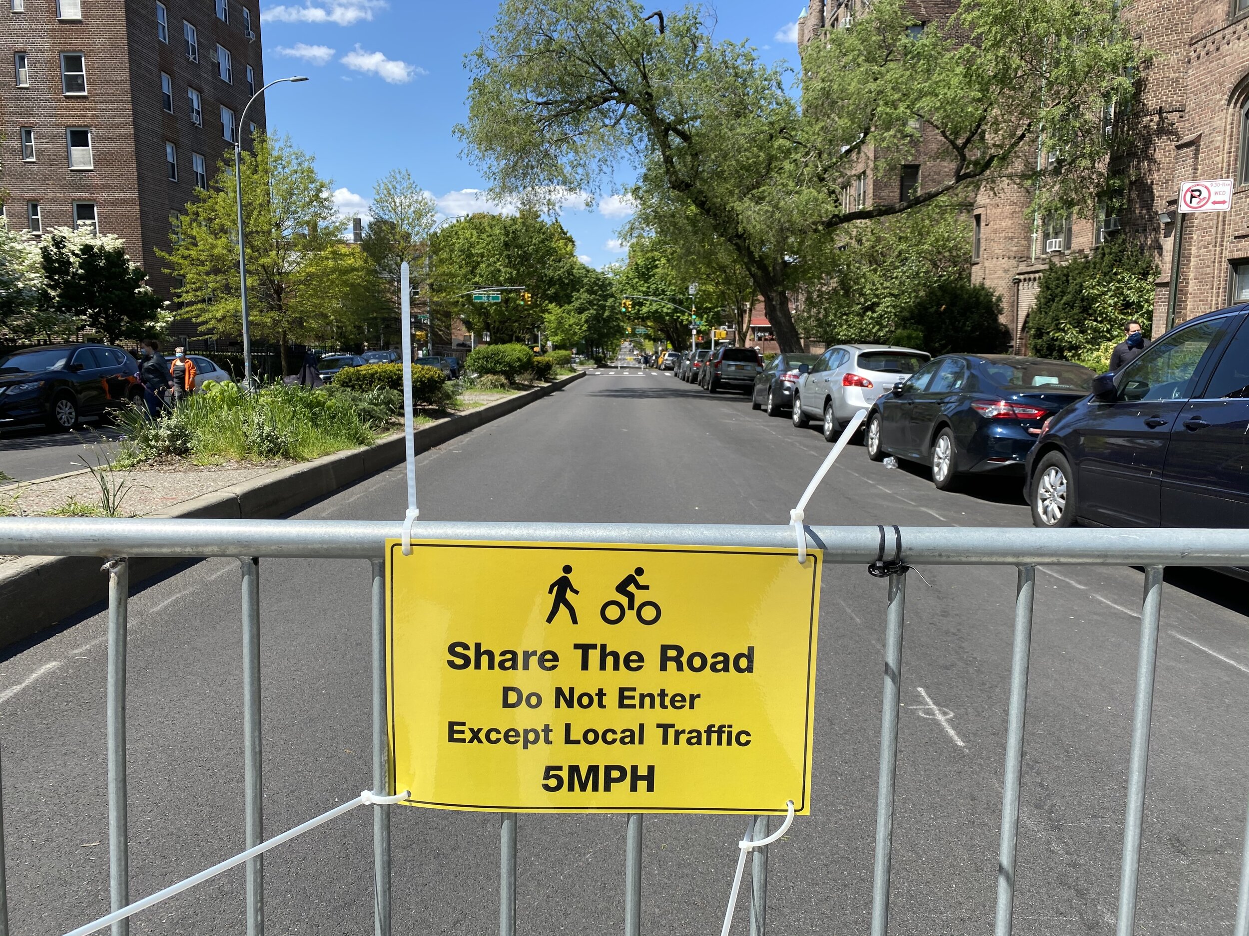
A stretch of 34th Avenue in Jackson Heights is now closed to cars. Photo courtesy of Jeff Simmons
By David Brand
A city plan to provide pedestrians room to roam on carless roads has so far excluded Southeast Queens, a full two weeks after Mayor Bill de Blasio unveiled the first phase of the initiative.
The so-called “Open Streets” program will ban cars from a combined 40 miles of roadways across the city to allow New Yorkers to walk around while following social distancing orders. Most of the Queens streets are located in and around parks, including Forest Park and Flushing Meadows-Corona Park.
One street, a stretch of Roosevelt Avenue in Flushing, is located in the Northeast portion of the borough. The others — including streets in and around Astoria Park, Court Square and Sunnyside — are located in the Western and Central sections of Queens.
Councilmember Donovan Richards, a candidate for Queens borough president, called the exclusion of Southeast Queens “shameful” in response to an Eagle reporter’s tweet. Richards said the Department of Transportation agreed to review a list of possible streets in the region.
“But shameful we were left out in the first place!” he added in a tweet.
Richards said he would share the list of streets when it is ready.
A spokesperson for the DOT said the city has spoken with Richards and Southeast Queens elected officials about possible street closures.
“We look forward to working with them to identify locations for the coming rounds of Open Streets,” the spokesperson said.