Just one Queens street added to city map of car-banned roadways
/
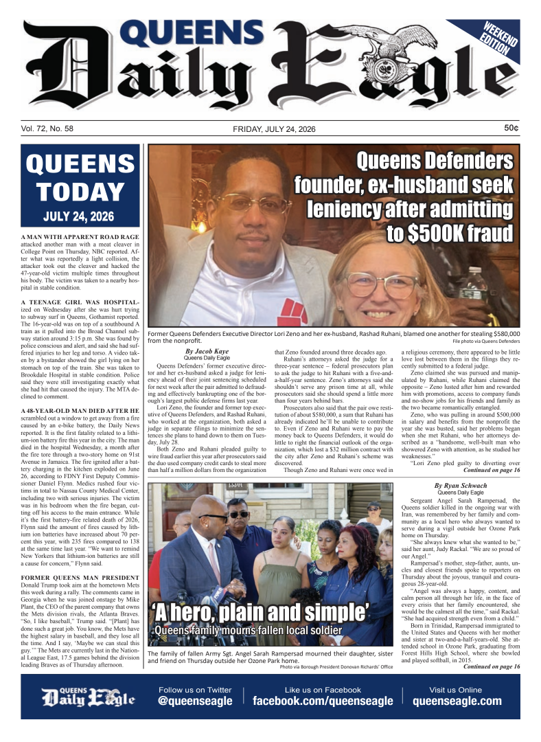
The newest street in the Open Streets initiative is near Travers Park in Jackson Heights. Photo via the NYC Parks Department
By Victoria Merlino
A single street in Queens was added Wednesday to the growing list of pedestrian boulevards that the city will close to cars to promote social distancing strolls during the coronavirus pandemic.
Mayor Bill de Blasio unveiled the second phase of the city’s “Open Streets” initiative during a press conference Wednesday. The city will once again ban cars along a strip of 34th Avenue between 69th Street and 77th Street in Jackson Heights from 8 a.m. to 8 p.m..
The roadway is located next to Travers Park and was part of the Open Streets pilot program last month.
“As the weather gets warmer, New Yorkers will need options to safely enjoy the sunshine — and we’re excited to give them even more options to do so,” de Blasio said in a statement.
The newly opened stretch of 34th Street is the fourth Queens location included in the city’s Open Streets plan.
Short strips in Forest Park and Flushing Meadows Corona Park — two park partitioned by busy streets or highways — were announced last week. A tiny patch of road near Court Square was included in the program as well.
The streets make up a fraction of the city’s goal for closing 40 miles of roadways to cars across the five boroughs.