Notorious Snake Road to be subject of flood study
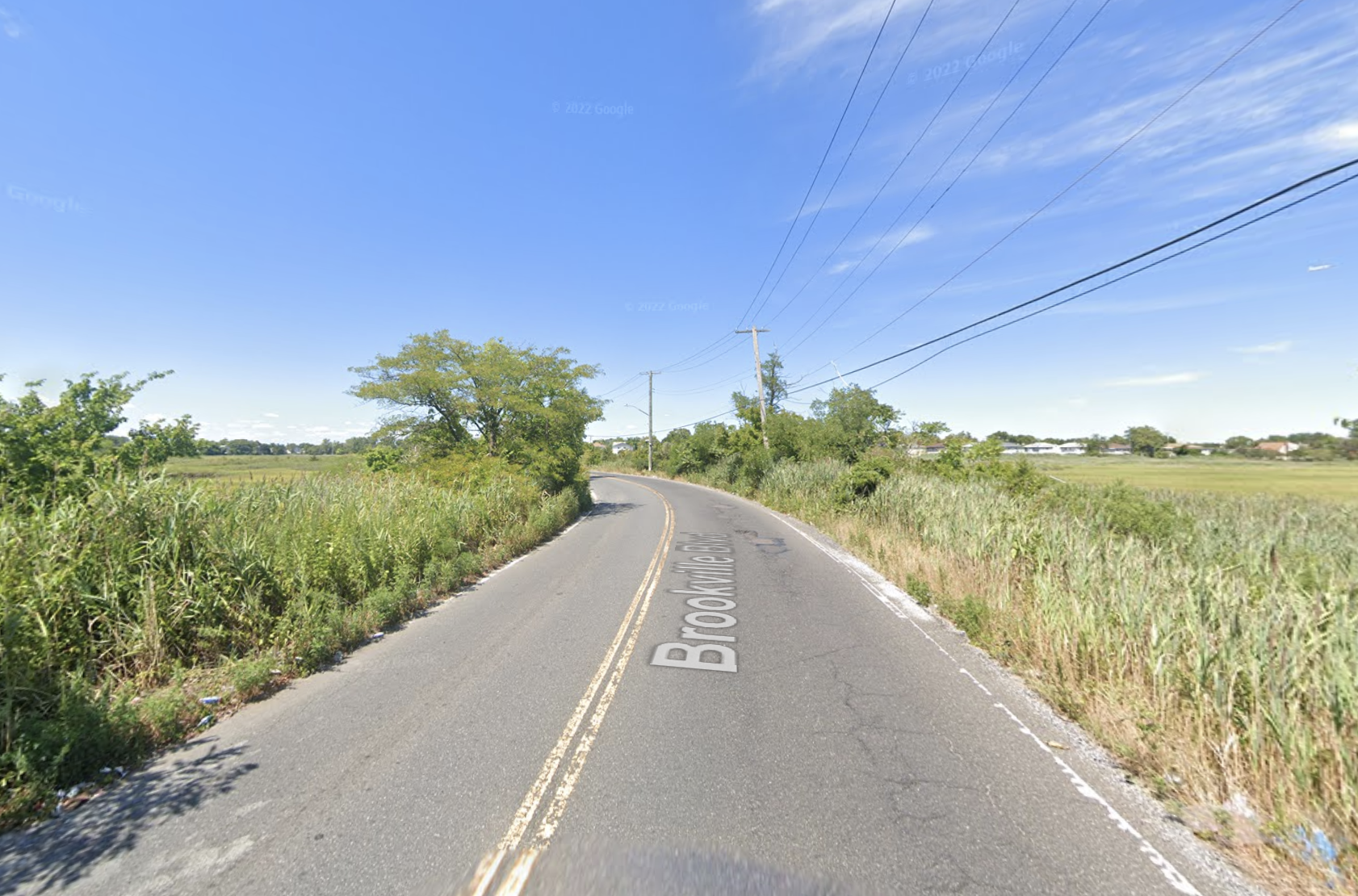
/Brookville Boulevard, better known to locals as Snake Road, is scheduled to undergo a flood mitigation study. Photo via Google Maps
By Ryan Schwach
A strip of road in Southeast Queens notorious for its tendency to flood will finally be the subject of a grant-funded study into potential flood mitigation methods, much to the joy of locals who have been asking for changes to the road for decades.
The chronically flooded Brookville Boulevard, better known to locals as Snake Road due to the way it winds in a serpent-like fashion through the wetlands of Idlewild Park, is now scheduled to undergo a flood mitigation study to determine what can be done to make the road safer for Queens commuters.
A total of $3.1 million worth of grant money from FEMA and the state will go toward the study – on top of $300,000 from the city – which looks to research and address constant flooding along the sea-level Snake Road.
The study will begin next year, according to the Department of Transportation, and will take a projected 30 months to complete.
The study will consider raising the existing roadway, rerouting the road way, or placing signs and warning devices to improve conditions ahead of any more costly capital improvements.
The road, albeit notorious for its turns and constant flooding, is also known to locals as a quicker route to get around
“It's very convenient,” said Community Board 13 Chair Mark McMillan, “It's a shortcut. If you live in Rosedale and you want to go south, that's a really good way.”
McMillan says that taking Snake Road saves an average of 15 to 20 minutes in either direction for local commuters who work on the Rockaway peninsula or out in Long Island.
However, during times of high tide and storm periods, taking that shortcut for the high reward, comes at an equally high risk.
“Once you get on the road, you can't even really make a U-turn to get off it,” said McMillan. “So once you arrive, you're committed.”
This often results in commuters trying to use the road before it is officially shut, and then getting stuck.
The problems have been pervasive for sometime. The issue is so bad, in fact, that the MTA pulled their bus routes from the strip in 2019.
“If it rains, you can't pass it,” said local Assemblymember Khaleel Anderson. “If it rains, it pours, literally and figuratively.”
Brookville Boulevard traverse through Idlewild Park between Rosedale in Southeast Queens and the Five Towns on Long Island. Screenshot from Google Maps
The road’s isolation has also made it a dumping ground for contractors and others disposing of garbage, Anderson said, another challenge that has been met via new cameras in the area pushed by Councilmember Selvena Brooks-Powers.
Despite being discussed by locals in the surrounding communities of Rosedale, Brookville, Far Rockaway and others for decades, locals and officials chalk the inaction up to government bureaucracy and the complicated environmental area the road cuts through.
“It should have been dealt with a long time ago,” said State Senator James Sanders. “The problem is that all three levels of government are involved. The wetlands are federal property and some of the road is state property, and most of it is city. So each level of government was able to point the finger at the other level and say that they had a problem.”
Sanders argues that the bureaucracy and disagreement between levels of government are responsible for the years of unheard community complaints.
“When that happens, bureaucracy is able to hide, able to do nothing by blaming the other guy,” he said. “What needed to happen was that the vision and the will needed to come together, that all three levels of government, federal, state and city had to work together.”
The other major hurdle came with the protected and rare animals that live on the preserve the road cuts through, like ospreys, fiddler crabs and diamondback terrapins.
“It is on state protected land,” said McMillan. “You really can't do a lot with it, and there are a lot of endangered species that are protected.”
Anderson for one hopes that whatever comes out of the study indicates a way that the road can be made safer for Southeast Queens residents, and the animal residents.
“My hope is that we'll be able to preserve the wildlife in that era that use that road as a crossing while also responding to climate change and also responding to poor design,” he told the Eagle.
Anderson would also like to see ways the road’s new look can benefit the wildlife as well through green spaces and ways the community can participate in nature.
“I want there to be interaction between communities and the wildlife that is there,” he said.
The main goal for electeds and locals involves raising the road so it no longer sits right at sea level, where it is susceptible to high tides.
Queens State Senator James Sanders Jr. says that locals have been asking for changes to Snake Road for decades. Photo New York State Senate
“I’d love this road to be raised by more than six feet, taking into account global climate change,” said Sanders. “So that even as the waters rise, we won't have this problem again. Let's not just do a temporary little fix when we're back here and before the ink is dry on the paper.”
Twice in the last year there have been major flooding events, once last December and the other in late September, which saw Snake Road closed and completely flooded.
Locals also hope the plan for the roadway could include bike lanes, as well as fences to limit the dumping issue.
“If you could figure out a design that could make the roadway a little higher without impacting the protective marshland, that would be ideal,” said McMillan. “It's a step in the right direction. This needs to happen.”
Despite the years of unanswered calls for improvements at Snake Road, local electeds are calling the impending study a big victory.
“My hope is that we can close the chapter on what has been a decades-long cluster of environmental racism, coupled with poor design and poor city planning, among other things, and also poor coordination with the three levels of government,” said Anderson.
“We would be remiss if we didn't say that is a big, big victory for these residents,” he added. “They've been fighting for this for decades.”
Sanders, who has served in office since 2002, and says community meetings are expected to come on the plan, believes that there is no better time to act.
“There's an African saying that the best time to plant a tree is 20 years ago,” he said. “Second best time is now.”


